Vietnam is a country in Southeast Asia. The geography of Vietnam offers a fascinating array of landscapes and natural features, making it an alluring destination for travelers. This article will give you the geographic highlights of the three main regions of Vietnam: the North, Central, and South. If you are planning a Vietnam travel journey, read on to discover its breathtaking natural beauty.
1. Where is Vietnam on the world map?
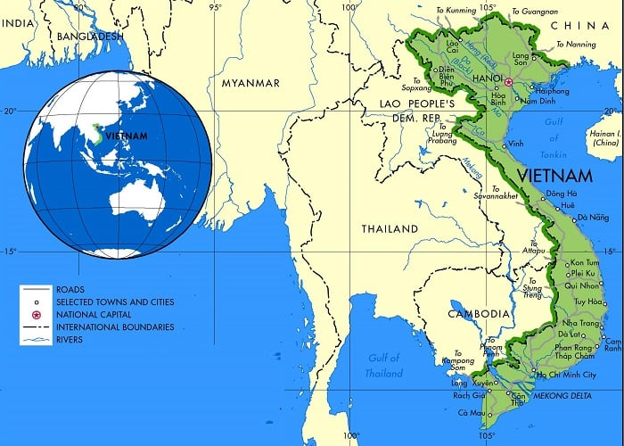
Vietnam is located in the center of Southeast Asia and covers an area of 331,698 square kilometers. It shares borders with China to the north, Laos and Cambodia to the west, and faces the East Sea and the Pacific Ocean to the east and southeast, respectively. Despite having a relatively short land border of only 4,550 kilometers, Vietnam boasts an impressive sea border of 3,260 kilometers, stretching from Mong Cai in the north to Ha Tien in the southwest.
Vietnam is often referred to as the "S-shaped country" due to its unique shape on the world map, which resembles the letter "S". It stretches 1,650 kilometers from north to south, with the widest point on the mainland measuring 500 kilometers and the narrowest point just 50 kilometers wide. The geography of Vietnam is diverse, from towering mountains to lush deltas and pristine beaches. To get a better understanding of the country's diverse topography and its shape, you can refer to a Vietnam geography map.
Vietnam uses the Vietnam Standard Time, which is seven hours ahead of the Coordinated Universal Time. Unlike some other countries, Vietnam does not observe daylight saving time. The VST time zone is used across the entire country.
>>> Read more: Vietnam things to do: 10 MUST-HAVE experiences on a first visit
2. Geographic features of 3 regions of Vietnam
The geography of Vietnam is varied, with the mountainous terrain dominating the north, the scenic coastal views and stunning beaches covering the central region, and the fertile Mekong Delta shaping the landscape of the south. Here is a closer look at each region:
2.1. Northern Vietnam - A haven for adventure seekers
Northern Vietnam includes the mountainous terrain of Northeast and Northwest Vietnam, as well as the fertile Red River Delta that stretches along the northern coast.
2.1.1. Northeast Vietnam Geography
The Northeast region of Vietnam includes Phu Tho, Tuyen Quang, Thai Nguyen, Cao Bang, Ha Giang, Bac Kan, Lang Son, and Bac Giang provinces. It shares borders with China to the north and east, and the Northwest and Red River Delta to the west and south. The region is characterized by mountainous terrain and a tropical monsoon climate. Summers are hot and humid, while winters are cool and dry.
The geography of Vietnam’s Northeast is also dominated by the Red River, which runs through the region from the northwest to the east, creating a fertile valley that is ideal for agriculture. This valley is home to many ethnic minority groups, each with their own distinct culture and traditions.
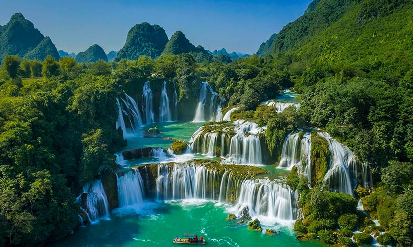
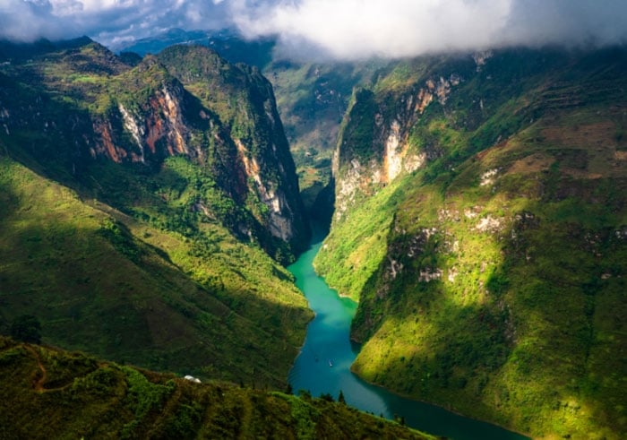
Northeast Vietnam also boasts many popular tourist attractions, including the breathtaking Ban Gioc Waterfall, the forest and cliff-surrounded Ba Be Lake, the panoramic views from Ma Pi Leng Pass, the Pac Bo relic site where Ho Chi Minh returned to Vietnam, the unique geological formations of Dong Van Karst Plateau Geopark, etc.
2.1.2. Northwest Vietnam
The Northwest region of Vietnam includes the provinces of Lao Cai, Yen Bai, Dien Bien, Hoa Binh, Lai Chau, and Son La. It is a mountainous region located in the upper part of Vietnam, sharing borders with China and Laos. The geography of Vietnam’s Northwest is characterized by its rugged mountains, with Hoang Lien Son mountain range dominating the landscape. The Northwest is also distinguished by its stunning natural beauty, with terraced rice paddies, towering mountains, and lush forests.
Compared to other regions of Vietnam, the climate in the Northwest is cooler and drier, with temperatures ranging from 10 to 20 degrees Celsius in the winter and 20 to 30 degrees Celsius in the summer.
The Northwest also offers plenty of popular tourist destinations, such as the culturally diverse mountain town of Sapa, Fansipan - the highest peak in Vietnam, the beautiful terraced rice paddies of Mu Cang Chai, the historically significant city of Dien Bien Phu, the peaceful valley of Mai Chau, etc.
>>> Read more: Vietnam where to go: The 10 HOTTEST destinations in 2025
2.1.3. Red River Delta
The Red River Delta comprises 10 provinces and 1 city, namely Bac Ninh, Ha Nam, Hanoi, Hai Duong, Hai Phong, Hung Yen, Nam Dinh, Ninh Binh, Thai Binh, Vinh Phuc, and Quang Ninh. It is bordered by the Northeast region to the north, the Northwest region to the west, and the Gulf of Tonkin to the east.
The geography of Vietnam’s Red River Delta is influenced by a humid tropical monsoon climate. It has hot summers and cool winters, and experiences a high level of rainfall throughout the year. This climate fosters the region's agricultural productivity, especially in rice cultivation. It is one of the major rice-producing regions in Vietnam, with a long history of rice cultivation dating back to ancient times.
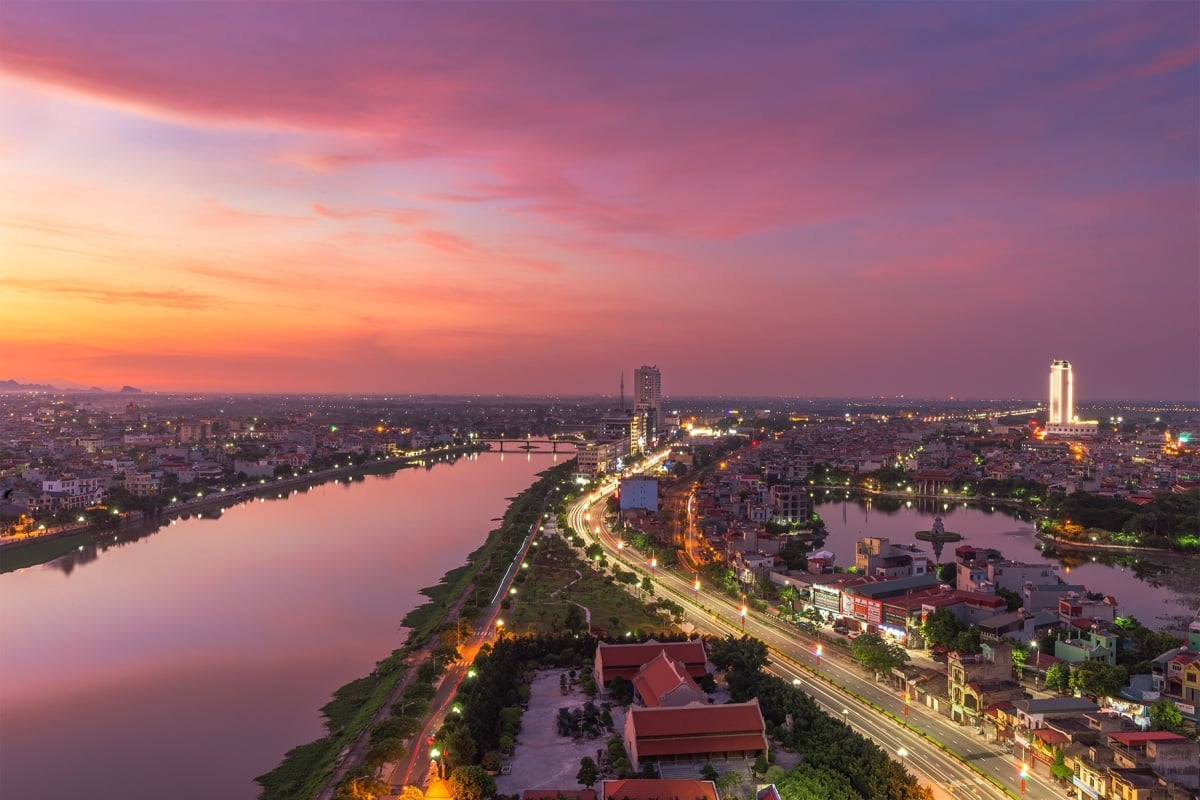
The Red River Delta is home to an abundance of tourist destinations, such as the stunning Tam Coc - Bich Dong with its limestone cliffs and rice paddies, the oldest Cuc Phuong National Park with its diverse flora and fauna, the peaceful Hoan Kiem Lake that is a must-visit in any Hanoi travel itinerary, the picturesque Tam Dao with cool weather and breathtaking scenery, and the world-renowned Ha Long Bay - a UNESCO World Heritage Site with towering limestone islands and emerald waters.
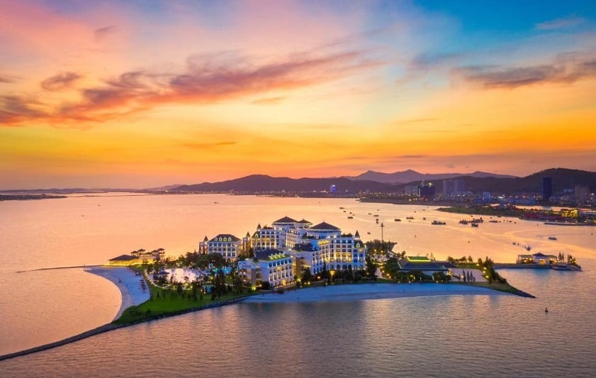
If you are planning to visit Ha Long Bay, it is highly recommended that you stay at a reliable place such as Vinpearl Resort & Spa Ha Long. This luxurious resort is situated on Reu Island, offering spectacular views of the bay and its majestic limestone cliffs. With a wide range of room options, from deluxe rooms to suites, you can find the perfect accommodation to suit your needs. The resort also offers professional services including a spa, gym, outdoor swimming pool, and restaurants, ensuring that you enjoy the ultimate comfort for an unforgettable vacation in Ha Long Bay.
>>> Book rooms in Vinpearl Resort & Spa Ha Long to have the ultimate comfort on your journey!
2.2. Central Vietnam - Blessed with picture-perfect forests and beaches
The geography of Vietnam in Central Vietnam is divided into the North Central Coast, South Central Coast, and Central Highlands, each with its own unique natural features.
2.2.1 North Central Coast Vietnam Geography
The North Central Coast spans across the provinces of Thanh Hoa, Nghe An, Ha Tinh, Quang Binh, Quang Tri, and Thua Thien Hue. It borders the northern region of Vietnam to the north, the South Central Coast to the south, the Annamite Range and Laos to the west, and the East Sea to the east.
The geography of Vietnam’s North Central Coast is characterized by its narrow coastal plains, rugged mountains, and numerous rivers. The Annamite Range runs through the western part of the region, creating a natural barrier between the coast and the Central Highlands. The North Central Coast has a tropical climate, with hot and humid summers and cool and dry winters. It also experiences monsoons, with heavy rainfall from September to December.
This land also offers some of the most famous attractions in Vietnam, such as the picturesque Sam Son Beach with its long stretch of white sand and clear blue water, the scenic Perfume River that flows through Hue, the Imperial City of Hue - a UNESCO World Heritage Site and former imperial capital of Vietnam, the pristine Lang Co Beach with stunning mountain views, the breathtaking Phong Nha - Ke Bang National Park - a UNESCO World Heritage Site and home to some of the world's largest and most stunning caves, etc.
2.2.2. South Central Coast Vietnam
The South Central Coast region is composed of eight provinces, including Da Nang, Quang Nam, Quang Ngai, Binh Dinh, Phu Yen, Khanh Hoa, Ninh Thuan, and Binh Thuan. The region spans from the southern end of Hai Van Pass in Thua Thien Hue province to the southern boundary of Binh Thuan province. It is bordered by the North Central Coast to the north and the Southeast to the south.
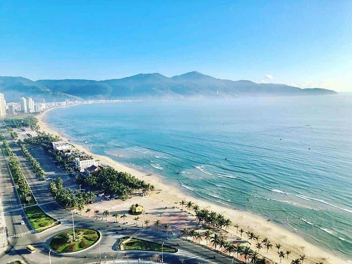
The geography of Vietnam in this region boasts a diverse landscape of sandy beaches and mountain ranges. The climate here is typically hot and humid, with temperatures ranging from 22 to 32 degrees Celsius. The rainy season lasts from September to December, while the dry season lasts from January to August.
Like other regions in Vietnam, the South Central Coast also has numerous notable attractions that draw tourists from all over the world, such as My Khe Beach - one of the most attractive beaches on the planet voted by Forbes, Hoi An Ancient Town - a charming UNESCO World Heritage Site with lantern-lit streets, My Son Sanctuary - another UNESCO World Heritage Site and ancient Hindu temple complex that dates back to the Champa Kingdom, Hon Mun Island - a marine reserve in Nha Trang known for its clear waters and abundant marine life, Ponagar Cham Towers - a group of Cham temples that dates back to the 8th to 13th centuries, etc.
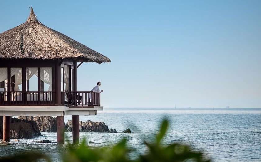
For any destination that you intend to visit in the South Central Coast region, it is recommended that you make plans in advance to ensure the best experience. Whether you choose to explore Da Nang, Nha Trang, Hoi An, or other places, make sure to try the local cuisine and participate in various activities. For accommodation, consider staying at Vinpearl, a leading brand in Vietnam that is renowned for exceptional hospitality. Choosing Vinpearl, you can enjoy their unparalleled services while taking in the beauty of nature.
Below are some Vinpearl hotels and resorts that you can consider:
- Vinpearl Resort & Golf Nam Hoi An: provides guests with easy access to the city's top attractions. You can easily explore the ancient town's history and culture, try the delicious local cuisine, shop for handmade crafts at the famous night market, and visit VinWonders Nam Hoi An, an entertainment and cultural paradise for visitors of all ages. Additionally, Vinpearl offers luxurious services and modern facilities that will surely provide the best accommodation experience during your stay.
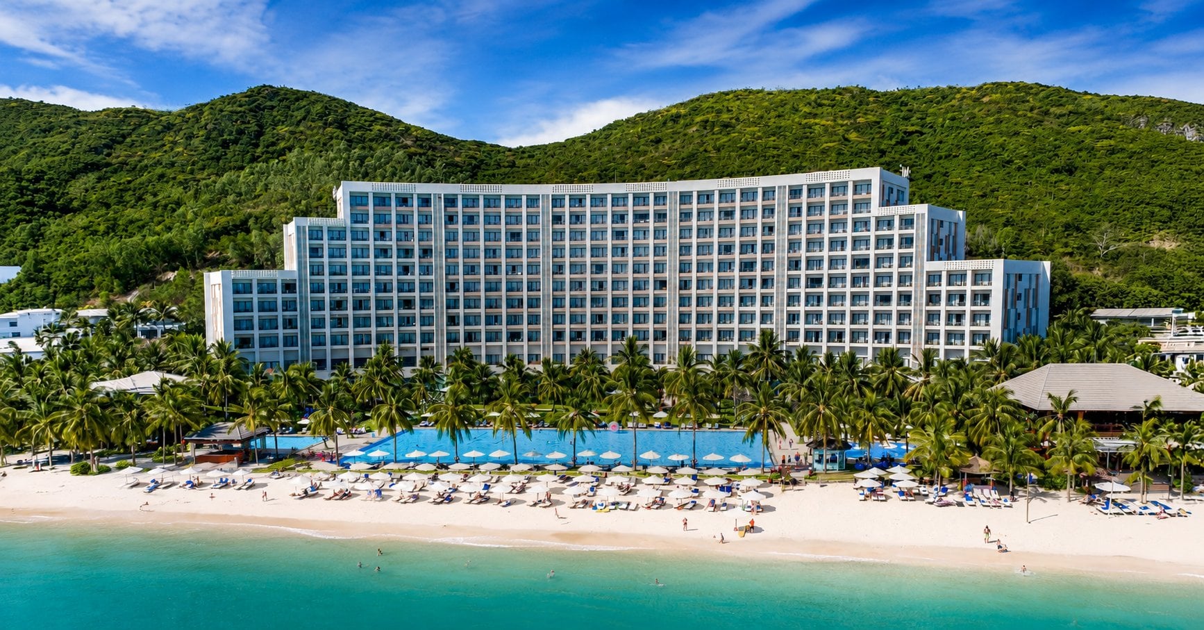
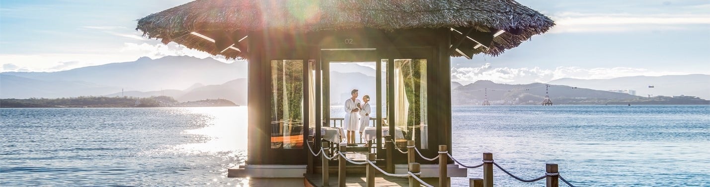
- Vinpearl Nha Trang: This luxurious hotel and resort system boasts a large number of 5-star rooms with breathtaking views. You can also take advantage of their top-notch amenities, such as spas, gyms, bars, swimming pools, luxury restaurants, and especially VinWonders Nha Trang, an amusement park of groundbreaking records that will make your heart race.

>>> Book rooms at Vinpearl Nha Trang, Vinpearl Resort & Golf Nam Hoi An to have a comfortable stay after exploring the geography of Vietnam in the South Central Coast region!
2.2.3. Central Highlands Geography of Vietnam
The Central Highlands (Tay Nguyen) region consists of Kon Tum, Gia Lai, Dak Lak, Dak Nong, and Lam Dong provinces. It borders the lower part of Laos and northeastern Cambodia.
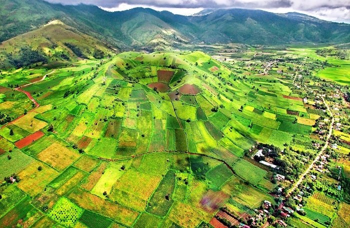
The geography of Vietnam in the Central Highlands is characterized by rolling hills and plateaus. The region lies on a series of contiguous plateaus, with an average elevation of 500-700 meters above sea level. All of these plateaus are surrounded by high mountain ranges and massifs to the east. The climate here is generally cooler and less humid than in the coastal regions, with temperatures ranging from 15 to 28 degrees Celsius.
Moreover, the region is home to several major rivers, including the Serepok, Ba, and Dong Nai rivers, which serve as important water sources, facilitate agriculture, and boost hydroelectric power production. The Central Highlands is also known for its extensive forests, which cover over half of the region's total area.
Some of the most famous tourist attractions in the Central Highlands are Langbiang - the highest peak in the region that offers breathtaking views of the surrounding mountains and valleys, the Valley of Love - a picturesque valley in Da Lat famous for its romantic atmosphere and stunning scenery, Mang Den Ecotourism Area - a nature reserve of pristine forests, waterfalls, and wildlife, Da Lat Flower Park - a botanical garden that showcases a vast array of colorful flowers and plants, Lak Lake - the largest natural lake in the Central Highlands, and many more.
>>> Read more: Climate in Vietnam: Details about weather, temperature and more
2.3. Southern Vietnam - An ideal destination for culture lovers and history buffs
South Vietnam, including Southeast Vietnam and Mekong Delta, is characterized by flat terrain with a dense network of rivers and canals.
2.3.1. Southeast Vietnam
Southeast Vietnam includes Binh Phuoc, Tay Ninh, Binh Duong, Dong Nai, Ba Ria - Vung Tau, and Ho Chi Minh City. Southeast Vietnam borders the Mekong River Delta to the west and southwest, and the East Sea to the east and southeast. It also shares a border with Cambodia to the northwest.
The geography of Vietnam's Southeast is influenced by a tropical climate, with high humidity and frequent rainfall throughout the year. Monsoons also impact the region, bringing a rainy season from May to November and a dry season from December to April.
The region is dominated by the Mekong River Delta, which is the largest delta in Vietnam and one of the most productive agricultural areas in the world. The Mekong River is an important source of water and food for the region. Besides, several other major rivers, including Dong Nai River and Saigon River, also provide water and facilitate transportation for the region.
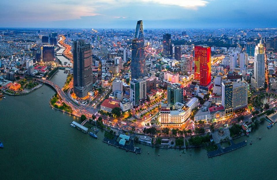
Southeast Vietnam is also known for its beautiful beaches and bustling cities. Some notable attractions in the region include the iconic Ben Thanh Market in Saigon - which offers a diverse selection of goods, Cu Chi Tunnels - a popular destination for history and warfare enthusiasts, Front Beach (Bai Truoc) - a picturesque beach in Vung Tau renowned for crystal-clear water and powdery sands, Ba Den Mountain - a significant pilgrimage site for Buddhists, and many more.
>>> Read more: Vietnamese food: The TOP 10 must-try dishes in 2025
2.3.2. Mekong Delta Geography of Vietnam
The Mekong Delta includes Long An, Tien Giang, Ben Tre, Tra Vinh, Vinh Long, Dong Thap, An Giang, Kien Giang, Can Tho, Hau Giang, Soc Trang, Bac Lieu, and Ca Mau provinces. It is a region in southwestern Vietnam where the Mekong River empties into the South China Sea. It is the largest rice-producing region in Vietnam and is a crucial contributor to the country's food supply. The region is also famous for its lush green rice paddies, fruit orchards, and winding canals.
The geography of Vietnam in the Mekong Delta is characterized by a tropical climate. There are two main seasons here: the rainy season from May to November, and the dry season from December to April. The region is also affected by annual flooding, which provides nutrient-rich sediment to the rice paddies and other crops.
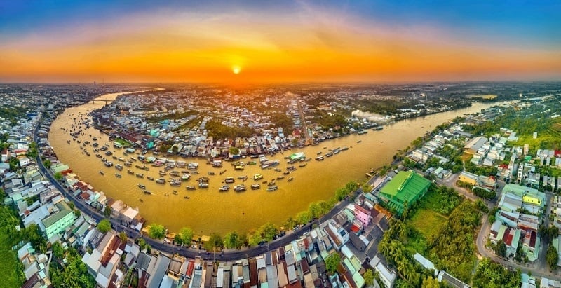
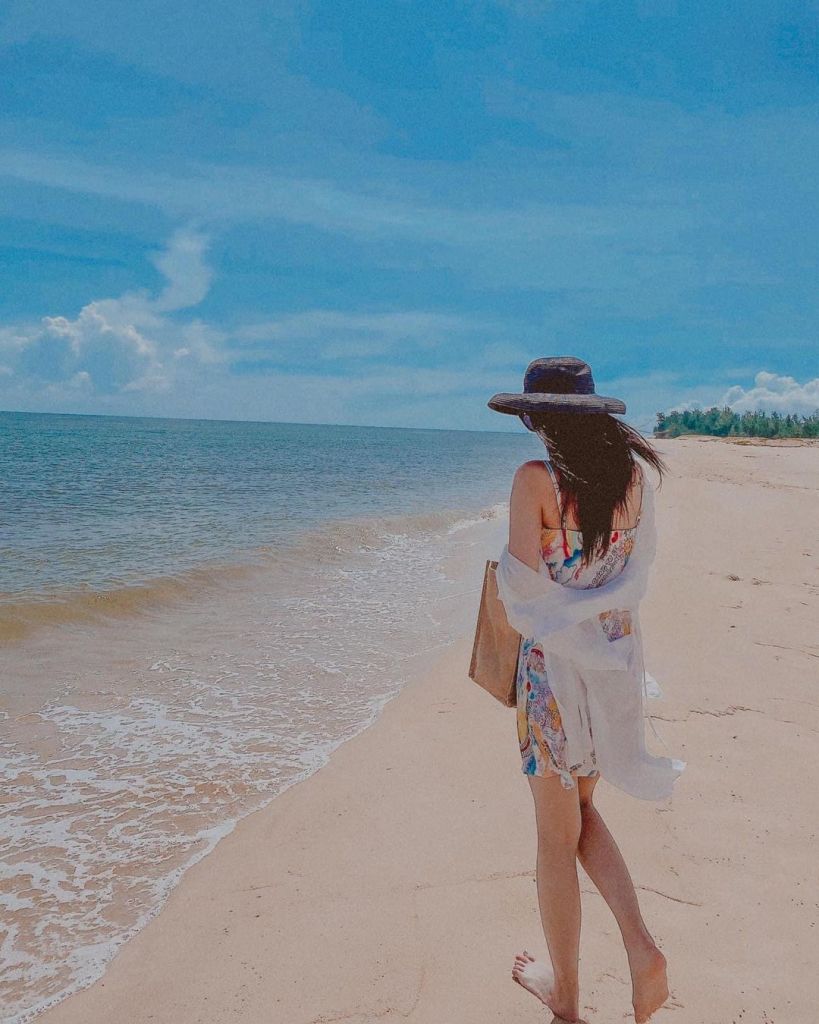
Tourism is an important industry in the Mekong Delta, with visitors coming to explore the floating markets, visit the traditional villages, and experience the unique culture of the region. Some of the most popular tourist attractions in the Mekong Delta include Cai Rang Floating Market - one of the largest and most famous floating markets in the region, Binh Thuy Ancient House - a well-preserved ancient house featuring a unique blend of French and Vietnamese architectural styles, Phong Dien Orchard - a fruit orchard offering a wide variety of tropical fruits, Thien Vien Truc Lam Phuong Nam - a Buddhist monastery offering stunning views of the surrounding countryside, and Phu Quoc - a pristine island known for its captivating beaches, coral reefs, and marine life.
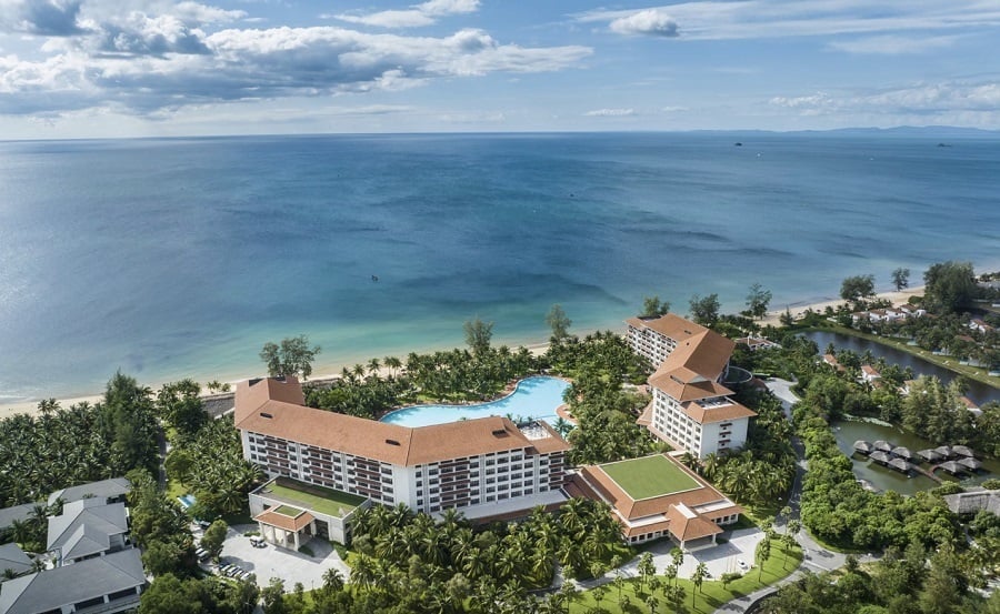
When planning your vacation in Phu Quoc, it is recommended that you stay at the hotels and resorts of Vinpearl Phu Quoc for the ultimate experience. With world-class accommodation and top-of-the-line amenities, such as outdoor swimming pools, children's playgrounds, babysitting services, restaurants, bars, and gyms, Vinpearl Phu Quoc provides an all-in-one experience that caters to even the most demanding customers.
Moreover, Vinpearl Phu Quoc offers easy access to some of the most captivating tourist attractions in the area, such as VinWonders Phu Quoc, Grand World Phu Quoc, and Vinpearl Safari Phu Quoc. By choosing Vinpearl Phu Quoc for your stay, you can ensure a truly luxurious and convenient vacation experience.
>>> Book rooms at Vinpearl Phu Quoc to pamper yourself with top-notch amenities and services on the pearl island!
The varied geography of Vietnam offers numerous magnificent destinations for travelers to explore. From the majestic mountains in the north to the winding rivers in the south, Vietnam has something for everyone. With so much to discover in this captivating country, start packing your bags and get ready for an unforgettable adventure!
>>> Book rooms in Vinpearl Phu Quoc, Vinpearl Nha Trang, Vinpearl Resort & Golf Nam Hoi An, Vinpearl Resort & Spa Ha Long to experience the ultimate comfort during your trip to Vietnam!