1. Overview of Quy Nhon on map
Formerly, Quy Nhon was a city under the province of Binh Dinh. As of now, Binh Dinh Province has been merged into Gia Lai Province, under which Quy Nhon has also been reorganized.

Covering an area of 285 square kilometers, Quy Nhon once served as the southern gateway of the old Binh Dinh. It borders the East Sea to the east, the former districts of Tuy Phuoc and Van Canh to the west, the former districts of Tuy Phuoc and Phu Cat to the north, and Song Cau Town of the former province of Phu Yen to the south.
Where is Quy Nhon? Quy Nhon is located 1,065 kilometers south of Hanoi, 650 kilometers north of Ho Chi Minh City, 165 kilometers away from Pleiku, and 323 kilometers away from Da Nang. Before the administrative merger, Quy Nhon was a first-class urban center - Binh Dinh’s major hub for economy, politics, culture, science, and education. It has been recognized as one of Vietnam’s 12 urban cores, a hotspot for commerce and tourism of the South Central Coast.
>>> Explore: Is Quy Nhon worth visiting? 11+ highlights of the coastal gem
2. Administrative map of Quy Nhon, Vietnam
Previously, the Quy Nhon map comprised 17 wards and communes. Following the administrative merger, it was reorganized into into five wards - Quy Nhon, Quy Nhon Bac, Quy Nhon Nam, Quy Nhon Dong, Quy Nhon Tay - and one island commune - Nhon Chau.

>>> Discover: Is Quy Nhon safe? Honest insights & safety tips for travelers
3. Top attractions on the Quy Nhon map for tourists
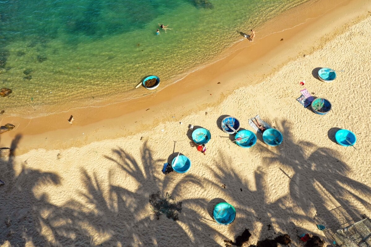
3.1. Hon Kho Beach
Hon Kho Beach on Hon Kho Islet retains its rustic charm with crystal-clear waters surrounded by colorful coral reefs, making snorkeling a highlight here. Tourists can also enjoy freshly prepared seafood dishes made by local fishermen. The panoramic view of the sea and Quy Nhon in the distance reveals the islet’s breathtaking beauty.
3.2. Ky Co Beach
Surrounded by mountains on three sides and the calm sea on the fourth, Ky Co Beach is often described as paradise on earth. Its turquoise water, white sand, and golden sunshine create a scene both poetic and majestic. Tourists can swim in the clear waves, collect shells, or watch tiny fish swept ashore. The beach offers activities such as jet skiing, parasailing, and camping.

3.3. Eo Gio
Looking at the Quy Nhon map, Eo Gio stands out as a crescent-shaped bay embraced by towering cliffs, known as one of the best sunset-watching spots in Vietnam. Strong winds and crashing waves have sculpted dramatic rock formations, giving the area its wild beauty. From the top, tourists can admire Nhon Ly Fishing Village, Phuoc Sa Pagoda, and a majestic statue of Guan Yin.
3.4. Bai Xep Beach
Just 13 kilometers away from the center of Quy Nhon, Bai Xep Beach is famous for its golden sands and rock formations emerging from the sea. The tranquil setting attracts young travelers looking for scenic photos and peaceful moments. Tourists can also explore the Bai Xep Fishing Village, where homestays, guesthouses, and resorts offer a glimpse into local life.
3.5. Ghenh Rang - Tien Sa
Ghenh Rang - Tien Sa is a prominent attraction on the Quy Nhon map. Nature has carved unique spots here, from Queen's Beach with its smooth egg-shaped pebbles to Vong Phu Rock, resembling a wife waiting for her husband, and the legendary Tien Sa Beach. Nearby lies the resting place of poet Han Mac Tu and the serene Ghenh Rang Church.
3.6. Banh It Cham Temple
Built in the late 11th - early 12th century, Banh It Cham Temple sits on a hill between two rivers. This temple complex includes four towers, each with unique designs, resembling the shape of a traditional “banh it” cake. With its intricate decorations, Banh It Cham Temple is considered one of Vietnam’s most artistic Cham relics.

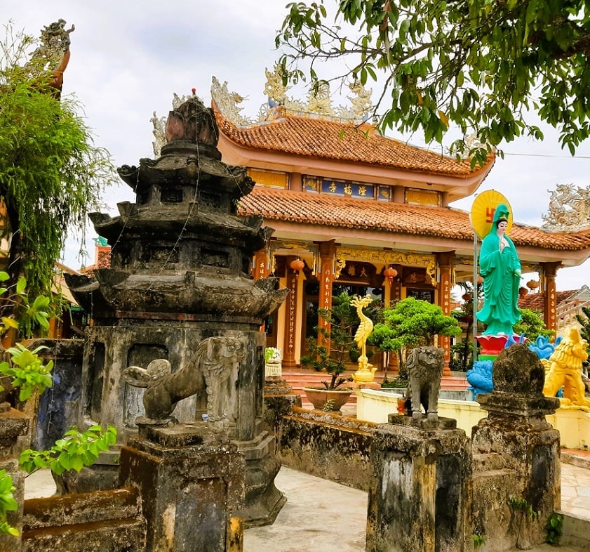
3.7. Ong Nui Temple
Another spiritual site on the Quy Nhon map for tourism is Ong Nui Temple, housing the largest seated Buddha statue in Southeast Asia. Tourists are advised to come in the early morning or late afternoon to avoid the heat and enjoy panoramic sea views from the mountainside. The temple features a traditional triple-arch gate, ancient halls, and beautifully decorated shrines.
3.8. Quy Nhon Cathedral
Quy Nhon Cathedral, often called the “pointed church” by locals, is an impressive European-style structure on the Quy Nhon map. Built in the shape of a cross, it stretches 57.5 meters long and 22.6 meters wide. Its white interior, colorful stained-glass windows, and statues create a solemn atmosphere, while the 47.2-meter-tall bell tower dominates the skyline.

3.9. Duong Long Cham Temple
Dating back to the late 12th century, Duong Long Cham Temple represents the golden era of Cham culture. This temple complex has three towers, the tallest rising 42 meters. Their brick bodies and stone-carved details showcase exquisite artistry, with mythical animals and vivid motifs etched directly into giant stones. Duong Long Cham Temple is regarded as one of the most beautiful Cham temple complexes in Vietnam.
3.10. Long Phuoc Pagoda
On the Quy Nhon map, Long Phuoc Pagoda is not only a serene spiritual site but also the cradle of Vietnamese martial arts. Surrounded by rice fields and bonsai trees, it houses ancient halls, stupas, and statues of the Eighteen Arhats. The pagoda preserves old texts on martial arts, trains generations of masters, and regularly hosts performances for tourists.
3.11. Thi Nai Lagoon
Thi Nai Lagoon, the largest of its kind in the region, spans over 5,000 hectares and stretches more than 10 kilometers. Rich in biodiversity, it is home to mangrove forests, 25 species of seagrass, 76 species of fish, and hundreds of birds. Here, there is a small temple honoring the sea god standing on an islet, adding a cultural charm. Tourists can enjoy boat rides, admire Phuong Mai Sand Dunes in the distance, or see the shimmering Thi Nai Bridge at night.
3.12. ExploraScience
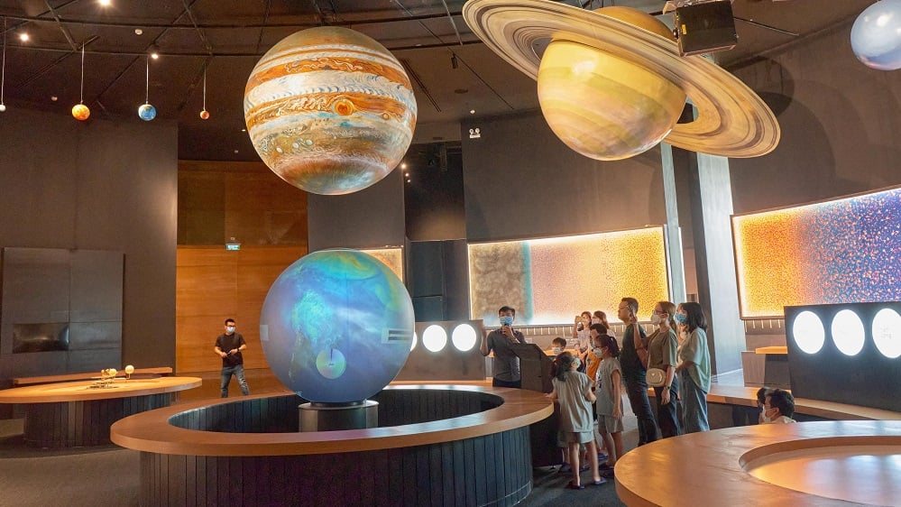
Regarding the Quy Nhon map for tourism, ExploraScience is an interactive science complex designed to inspire curiosity and creativity. This center features three main zones: a planetarium, a science museum, and an astronomical observatory. Tourists can explore cosmic images, interactive exhibits on science, or observe the night sky with telescopes. With a café, a library, and creative play areas, ExploraScience offers both education and leisure in a fun environment.
3.13. Nhon Ly Fishing Village
On the Quy Nhon map, Nhon Ly Fishing Village is a traditional seaside community where fishing remains the main livelihood. The fishing village preserves Cham relics and annual whale-worship festivals. Today, colorful murals brighten the narrow alleys, depicting marine life and daily scenes. Tourists can join the fishermen at sea, watch the sunrise, enjoy seafood, and capture vibrant photos here.
>>> Discover: Quy Nhon beaches: 11 idyllic coastal gems for unforgettable getaways
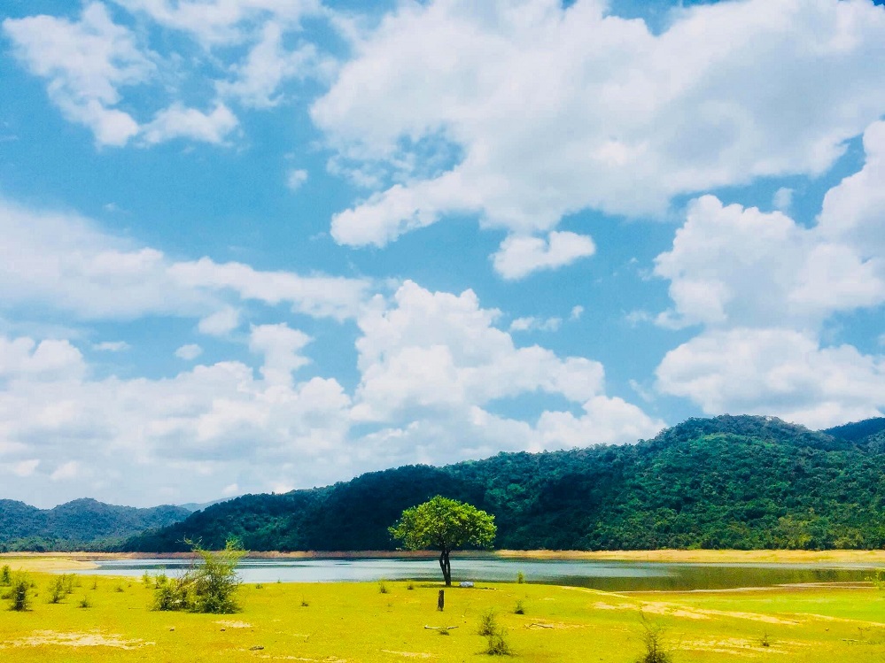
3.14. Nui Mot Lake
If you love nature, highlight Nui Mot Lake as a must-see on your Quy Nhon map. Surrounded by endless forests and mountains, it offers a tranquil escape. Here, tourists can stay in stilt houses by the lakeshore, hike 15 minutes to a roaring 30-meter-high waterfall, or enjoy a boat trip along shaded waterways. Meeting the Bana ethnic group, listening to lively gongs, and enjoying local delicacies add cultural depth to this idyllic natural retreat.
3.15. Lang Song Church
Located about 10 kilometers away from Quy Nhon, Lang Song Church is a serene Gothic-style landmark set among 200-year-old sao trees. Its arched windows, moss-covered walls, and spacious courtyard create a poetic charm. Birds chirp in the early morning, adding to the peaceful setting. Inside, tourists can explore preserved archives, including documents from the first printing house of Vietnamese Romanized script.
3.16. Thien Hung Pagoda
One of the most famous temples in the old Binh Dinh is Thien Hung Pagoda. Its grounds feature a 12-story bell tower, traditional curved-roof halls, large ponds, and lush greenery. The main hall faces rice fields and is surrounded by a moat. Thien Hung Pagoda is especially sacred as it houses the fifth Buddha relic gem, a gift from the Buddhist Sangha of Burma to Vietnam.

3.17. Trung Luong Camping Site
Trung Luong Camping Site is a popular outdoor getaway on the Quy Nhon map for young travelers. The site offers camping, overnight stays, beach activities, dining, coffee shops, and a scenic “Heaven’s Gate” photography spot. Surrounded by rocky mountains and blue seas, the area is enhanced with trees and flowers for a refreshing atmosphere. Tourists can set up tents, enjoy BBQs, and soak in the peaceful environment here.
3.18. Nguyen Tat Thanh Square
Another interesting attraction on the Quy Nhon map is Nguyen Tat Thanh Square, a vast public space situated at the end of Nguyen Tat Thanh Street. Its cool sea breezes make it a favorite gathering spot for locals on hot days. The square hosts major events such as the New Year’s fireworks, the Binh Dinh Martial Arts Festival, and large-scale sporting activities that attract thousands of participants from across the region.

3.19. Vi Rong Cape
Vi Rong Cape, or “Dragon Cape,” is a striking red, rocky formation jutting 20 meters into the sea. Waves crash through its hollow center, creating the illusion of a dragon spouting water. At sunset, the surrounding beaches look like a dragon soaring toward the ocean. Here, tourists can admire the vast sea views, watch fishing boats, explore hidden caves, or relax on the smooth rocks while listening to the sound of the waves.
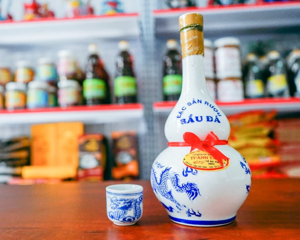
3.20. Bau Da Wine Village
On the Quy Nhon map for tourism, Bau Da Wine Village is the birthplace of the region’s famous rice wine. Produced by local families for generations, this liquor owes its distinctive taste to underground spring water and careful traditional distillation. Each 6-hour batch yields only 2.5-3 liters of strong, fragrant wine. Renowned for its purity and intensity, Bau Da wine pairs well with meals and makes a meaningful gift.
>>> Check out 15 things to do in Quy Nhon!
FAQs about the Quy Nhon map
Where is Quy Nhon located on the map?
Quy Nhon sits on Vietnam’s south-central coast. It is positioned roughly halfway between Da Nang to the north and Nha Trang to the south.
How do I find Quy Nhon on Google Maps?
Open Google Maps and type “Quy Nhon” into the search bar. It will appear along the coastline of central Vietnam.
What are the main areas of Quy Nhon to know on the map?
Key locations on the Quy Nhon map include the center around Nguyen Tat Thanh Street, Ghenh Rang, and Eo Gio.
How far is Phu Cat Airport from Quy Nhon on the map?
Phu Cat Airport (UIH) is located about 30 kilometers northwest of Quy Nhon. The drive usually takes around 45 minutes.
Is Quy Nhon easy to navigate with a map?
Yes. The layout of the Quy Nhon map is straightforward, with the coastline stretching north to south and most main roads running parallel to the beach.
>>> Explore: Quy Nhon weather: Climate and seasons overview for the best trip planning
The Quy Nhon map is more than just a navigation tool - it is a companion for discovering the beauty of this coastal gem. From vibrant squares and fishing villages to pristine beaches and hidden sites, the map helps travelers create memorable journeys. With a Quy Nhon map in hand, exploring becomes simple, enjoyable, and rewarding.
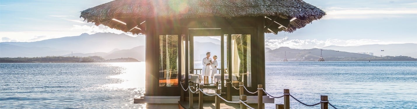
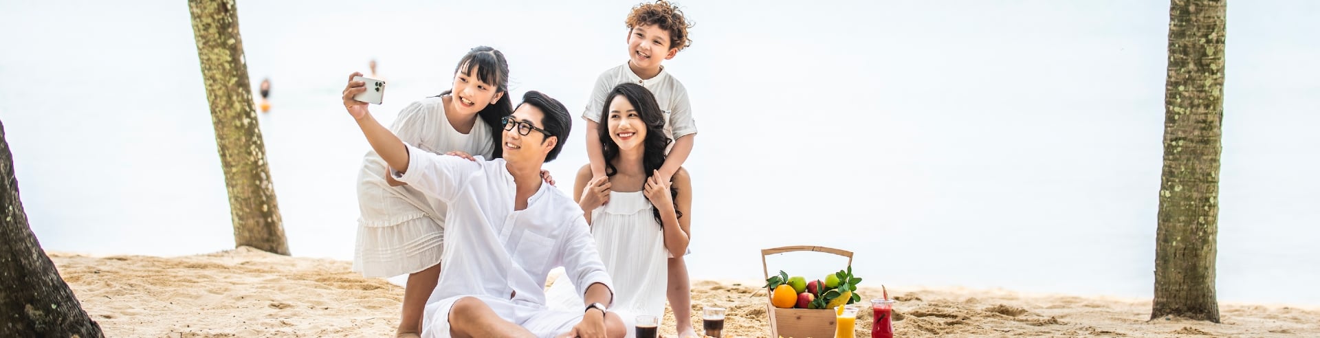
In addition to Quy Nhon, Vietnam is home to an incredible variety of other must-visit destinations like Hanoi, Ha Long, Hoi An, Nha Trang, and Phu Quoc. In these places, tourists can enjoy the elegant comfort of the hotels and resorts of Vinpearl. Vinpearl blends modern architecture with luxury amenities, offering everything from infinity pools and golf courses to gourmet restaurants and rejuvenating spas.
To complement the experience, the entertainment complexes of VinWonders deliver a world of excitement, from interactive games to themed attractions designed for all ages.